
In September of 1904, writes PBS, “William Mulholland, the man in charge of making sure Los Angeles had enough water, took a fateful camping trip. Together with one of the city’s former mayors, Fred Eaton, Mullholland drove northeast about 250 miles to the Owens Valley, where the Sierra Nevada mountain range stood off to the west, its gleaming snowcaps melting into streams that fed the Owens River—or to Mulholland’s eyes, what could be an abundant water supply for the distant city. In the coming years, Owens Valley residents, just then unaware of the Angelenos in their midst, would grow to deeply resent both Mulholland and what he stood for: a thirsty metropolis whose ever-increasing water needs took primacy over their own livelihood.”
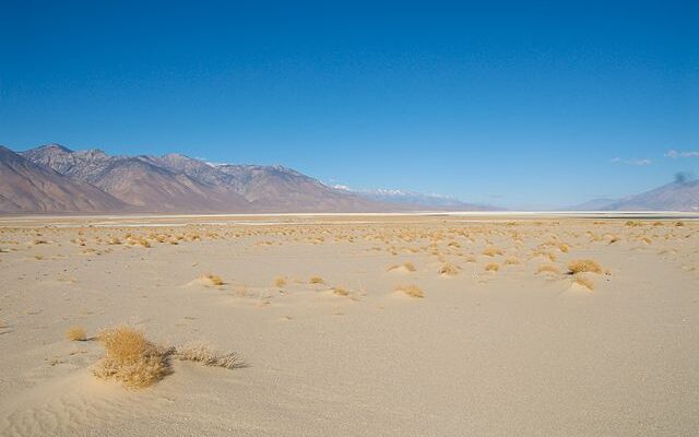
On November 5, 1913, William Mulholland got his wish to take the water from Owen’s Lake and send it to Los Angeles via an aqueduct 233 miles long. Within years, the lake began to turn into a dry hole in the ground. Although the City of Angels turned a lush valley into a desert, things have begun to change and nature has found a way.
The lake is returning.
The Daily Caller reports that “aerial footage shared in early June showed Owen Lake in California reaching its largest size in 110 years as snowpacks start to melt across the state.
A gif created by amateur meteorologist Colin McCarthy shows Owens Lake in the eastern Sierra Nevada region of California filling some 25 square miles of land. The lake was originally drained in 1913 by the Los Angeles aqueduct, but has made a comeback thanks to massive runoff from snowpacks created during California’s intense winter storms.
The lake is now at its largest size in some 110 years, McCarthy noted.”
Owens Lake, once one of the largest lakes in the Eastern Sierra before being drained by the LA Aqueduct in 1913, is making a major comeback due to heavy runoff generated by California's record winter.
The lake has grown to nearly 25 square miles, its largest size in 110 years. pic.twitter.com/efVYWEdCs6
— Colin McCarthy (@US_Stormwatch) June 2, 2023
Now NASA has explained what’s happening.
The space agency states that “California’s Owens Lake has been mostly dry since the construction of the Los Angeles Aqueduct in 1913. The project siphoned water from the eastern slopes of the Sierra Nevada range and Owens River Valley to the city of Los Angeles, 220 miles (354 kilometers) to the south, drawing down the lake.
That changed in March 2023 after floodwaters pooled on the west side of the aqueduct, eroded soil that supported the concrete-lined channel, and contributed to the collapse of three of its sections near Olancha. To drain and repair the damaged section of the aqueduct, the Los Angeles Department of Water and Power (LADWP) opened spill gates letting water run downstream. According to news reports, some of that floodwater joined with water from other sources and poured over the lakebed of Owens Lake.
Two weeks later, on March 25, the Moderate Resolution Imaging Spectroradiometer (MODIS) on NASA’s Terra satellite acquired this image (right) of Owens Lake. The image is false color, which makes the water (dark blue) stand out from its surroundings. Snow appears light blue and vegetation is green. The image on the left shows the same area in March 2022.
This is the first time the Los Angeles Aqueduct has been breached by extreme weather, according to the Los Angeles Times. But it is not the first time the lakebed has flooded since the construction of the aqueduct. Since the early 2000s, LADWP has occasionally flooded parts of the lake with shallow water to prevent dust from becoming airborne and potentially affecting human health.”
The people of Owen’s Valley have been fighting for their water rights for decades as their farms and ranches have suffered from drought. Although the water wars of California are likely to continue, hopefully, the people of the once lush valley east of LA will finally be able to have a nice cold glass of ice water.